

A research team from Universitas Gadjah Mada (UGM) conducted a rapid assessment and field observations in several flood-affected areas in Aceh, Sumatra. The activities included mapping physical conditions, infrastructure access, environmental factors, and the social dynamics of affected communities. The results of this mapping are expected to serve as an important foundation for designing more adaptive and sustainable interventions. This knowledge-based approach positions scientific assessment as the basis for post-disaster recovery decision-making.
Based on the rapid field assessment conducted by Dr. Sigit Heru Murti BS and his team from the Faculty of Geography, disaster risk patterns in Aceh were found to vary significantly across regions.
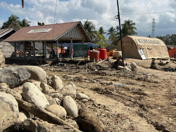
According to Dr. Murti, in urban areas such as Kuala Simpang City, Aceh Tamiang, infrastructure damage was recorded as extensive, even before reaching the city center. Subsequent impacts included health risks, particularly respiratory problems caused by drying mud dust.
These conditions indicate a direct link between physical damage and public health.
“Risk patterns in Aceh are not uniform, but range from structural damage in urban areas to hydrological issues in rural communities,” Dr. Murti said on Monday (Jan. 26).
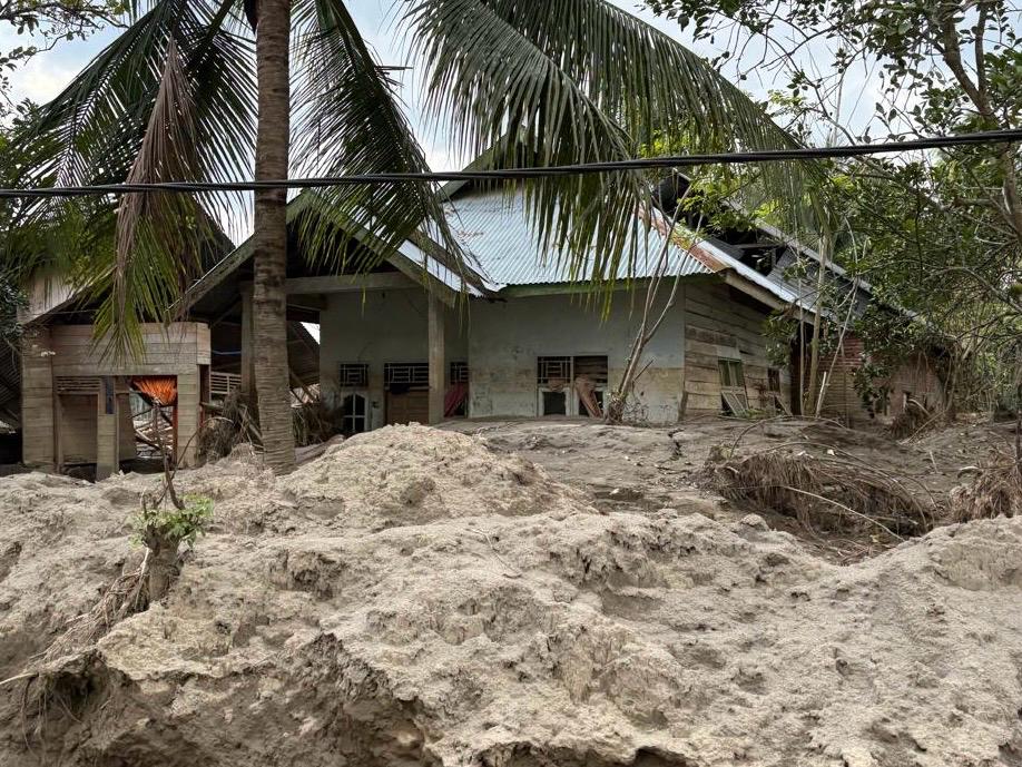
Dr. Murti explained that differences in risk characteristics are even more pronounced in rural areas. In North Aceh, flooding was triggered by overflowing irrigation canals, exacerbated by sedimentation from wood in the Oxbow Lake area, which caused floodwaters to spread into residential areas on the eastern side.
Meanwhile, in Pantan Kemuning Village, Bener Meriah, landslides resulted in damaged roads and disrupted electricity networks. Limited access slowed emergency response efforts and aid distribution.
“Each region has distinct risk characteristics that require specific handling based on local contexts,” he explained.
In addition to physical damage and access limitations, the field study also highlighted behavioral factors among communities during disasters.
In several areas of North Aceh, residents did not immediately evacuate because they were accustomed to routine flooding. This pattern is known as normalcy bias, where past experiences shape a misleading perception of the current level of danger.
As a result, some residents were trapped because the flood volume far exceeded normal conditions.
“Normalcy bias led residents to assume this flood was the same as previous ones, when in fact the volume was much greater,” Dr. Murti stated.
According to Dr. Murti, these findings underscore the need to shift disaster mitigation and preparedness approaches. Early warning systems should move from event-based to impact-based models that are easier for communities to understand.
Disaster education must emphasize that routine flooding does not always represent the same level of risk in every occurrence. On the other hand, local governments need more robust contingency plans to prepare for worst-case scenarios.
“The installation of early warning systems must be accompanied by community understanding of the most dangerous potential impacts,” Dr. Murti said.
Regarding post-disaster housing, Dr. Murti noted that permanent relocation is not always a realistic option. In densely populated areas such as Kuala Simpang, land limitations and strong social ties make cross-regional relocation difficult.
In-place adaptation or local relocation within the same area is considered more socially acceptable. Conversely, in landslide-prone areas such as Bener Meriah, relocation remains necessary but must be carefully planned.
“Adaptive housing and local relocation within the same village area tend to be more acceptable to communities,” Dr. Murti explained.
For example, the study recommends relocating residents from Geudumbak Village, North Aceh, to the western side of the irrigation canal. The location is considered safer while preserving residents’ social ties to their surroundings.
For permanent housing plans in other areas, in-depth social studies are a key prerequisite before implementation. Cross-village relocation can trigger resistance if not designed through participatory processes.
“Relocation must consider social bonds, not merely topographical aspects,” Dr. Murti emphasized.
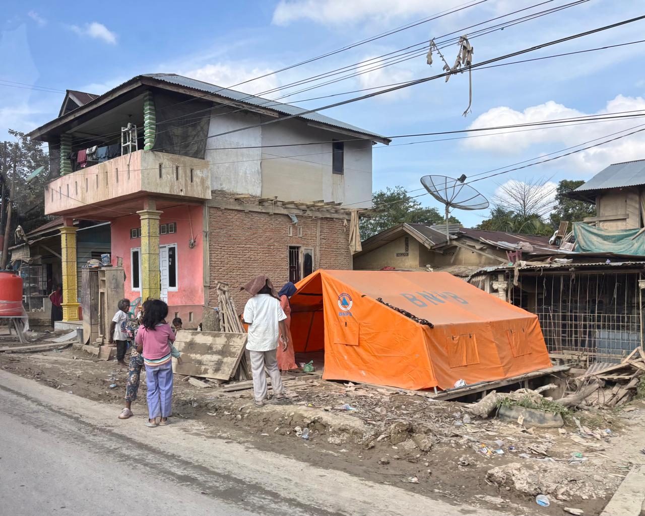
Furthermore, Dr. Murti highlighted that in addressing infrastructure and access limitations, universities play an essential role in providing adaptive solutions and integrated humanitarian responses. The implementation of temporary wood-frame housing was considered a rapid solution to meet emergency shelter needs.
Energy support from solar panels helps ensure electricity availability for clean water operations and basic services. These physical interventions should be carried out alongside psychological support and public health assistance.
“An integrated approach is more relevant than focusing solely on heavy infrastructure that is difficult to implement in a short time,” he explained.
As a medium- to long-term strategic recommendation, Dr. Murti emphasized the importance of integrated watershed management from upstream to downstream areas. Large-scale relocation of densely populated settlements in downstream regions is considered difficult to implement.
Therefore, controlling flood discharge through upstream spatial planning is a crucial step in reducing recurring risks. UGM is regarded as capable of conducting comprehensive studies that integrate hydrological, environmental, and social aspects.
“Watershed management is the key to addressing the root causes of flooding in Aceh in a sustainable manner,” Dr. Murti concluded.
Author: Triya Andriyani
Post-editor: Zabrina Kumara Putri
Photographs: UGM Researchers