• News Archive
  • Simaster
  • Webmail
  • Directory
  •  English
    • Indonesia
Universitas Gadjah Mada Universitas Gadjah Mada Universitas Gadjah Mada Universitas Gadjah Mada
  • Education
    • Doctoral dissertation
    • Inauguration of Professor
    • Graduation
  • Achievement
  • Research and Innovation
    • Research
    • Innovation
  • Campus Info
    • Cooperation
    • Seminar and Workshop
    • Student Community Service Program
    • Other
  • News Report
  • Home
  • News Report
  • Observing South China Sea Polemics

Observing South China Sea Polemics

  • 24 June 2016, 14:37 WIB
  • By: Marwati
  • 1129
  • PDF Version
Membedah Polemik Laut Tiongkok Selatan

The South China Sea has come under the spotlight recently. Chinese seamen often seen taking the fish out from the South China Sea around the Natuna islands, which China claims as belonging to their traditional territory. Last Friday, a Chinese fishboat was arrested by the Indonesian Navy as it was caught doing illegal fishing in the Indonesian waters. In response, President Joko Widodo’s visit to Natuna on Thursday (23/6) reaffirms the fact that there is a serious issue on the area.

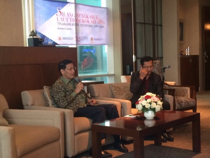
On the other hand, Geodetical Engineeering Department UGM, alumni association are aware that the issue is multidisciplinary. During this time, the South China Sea has only been discussed by political and legal experts while in fact there is a technical dimension or geospatial to that issue. This explains the background of the South China Sea Forum Group Discussion being held in the Menara Global in Jakarta that brought together former Foreign Affairs Minister, Dr. Hassan Wirajuda, and UGM alumni.
In the event Hassan Wirajuda submitted his views on the role and position of Indonesia on the South China Sea in the law and diplomacy context. “It’s very important for Indonesia to maintain a dialogue with China and other parties in that area,” said Dr. Wirajuda.

UN Convention negotiator on International Ocean Law, Prof. Djalal, said Indonesia had a strategic role to establish communication with signatories to always deal with the potential for conflict in the South China Sea.
At the same place, Head of Geospatial Information (BIG), Dr. Priyadi Kardono, reaffirmed the significance of geospatial information, such as maps, to enable giving a response to the territorial and jurisdiction conflict as what happened with the South China Sea.

Dr. I Made Andi Arsana, UGM Geodetical lecturer that focuses on ocean law geospatial aspect, especially maritime borders, also shared his views. He said that geospatial dimension was important to understand the South China Sea issue that so far has been seen merely in terms of the political and international relations.

“It’s crucial to know the position and dimension of the  potential for the South China Sea before we can suggest an option of solution,” said Andi.

Recommendation came up in the meeting, including that the South China Sea is a multidimensional issue that needs multidisciplinary approach to resolve. The government also has to be aware of the significance of earth sciences, such as Geodesy and especially geospatial (maps) information that is produced from the mapping process of earth surface in order to manage the sovereignty and jurisdiction of the Unitary State of the Republic of Indonesia that includes the South China Sea. The government should aslo maintain and increase leadership role in ASEAN through networking with member countries on the strategy to deal with this issue.

Related News

  • ASEAN Centres of Studies Asked to Explore South China Sea Dispute

    Tuesday,17 December 2019 - 10:52
  • UGM Receives Visit of University of South Carolina

    Tuesday,01 June 2010 - 8:56
  • 113 Asian Students Join ASEAN Youth Cultural Forum

    Wednesday,01 November 2017 - 15:22
  • UGM- GMUM Collaborate with China

    Wednesday,22 November 2017 - 9:10
  • UGM Student Joins Winter School in South Korea

    Tuesday,30 April 2019 - 14:39

News Releases

  • BPJT and UGM to Use AI to Monitor Toll Road Damage 22 January 2021
    The Toll Road Regulatory Agency (BPJT) collaborates
    Salma
  • Polgov UGM Earns 32 Billion NORHED Research Award 22 January 2021
    Research Center for UGM Politics and Government (Polgov) Department
    Natasa Adelayanti
  • Student of UGM Doctoral Program Conducts Research on Behavior of Precast Concrete Beam Joints 22 January 2021
    Hery Kristiyanto as a UGM student of the Civil Engineering Doctoral
    Natasa Adelayanti
  • Understanding the Importance of Covid-19 Vaccines 22 January 2021
    The UGM Update #DIRUMAHAJA talk series was back on T
    Salma
  • 793 Teaching and Academic Staff Receive Loyalty and Retirement Awards 22 January 2021
    A total of 793 teaching and academic staff at Universitas Gadjah Mad
    Salma

Info

  • Install Fest Windows
    29 September 2017
  • Streaming Author Workshop Writing and Publishing
    14 July 2017
  • Hokkaido University Short Term Exchange Program HUSTEP
    08 January 2016
  • 2016 Amgen Scholars Program in Japan
    08 January 2016
  • Jardine Foundation Scholarship for Postgraduate Studies at University of Oxford and University of Cambridge
    01 July 2015

Event

No latest event at this time

Universitas Gadjah Mada
UNIVERSITAS GADJAH MADA
Bulaksumur Yogyakarta 55281
   info@ugm.ac.id
   +62 (274) 588688
   +62 (274) 565223

PARTNERSHIP

  • Alumni
  • International Affairs

ABOUT UGM

  • Rector's Welcome
  • History
  • Vission and Mission
  • The Board of Executive
  • Management

VISIT UGM

  • Campus Map
  • Event

REGISTRATION

  • Undergraduate
  • Graduate
  • Vocational School
  • Professional Program
  • International Program

© 2021 Universitas Gadjah Mada

PRIVACY POLICYCONTACT