

In recent weeks, the community was busy discussing news widely spread in the mass media and discussion forums regarding the potential for a large earthquake that could cause a tsunami in southern Java. Some previous studies issued this statement, including the latest research conducted by an interdisciplinary team from the Bandung Institute of Technology (ITB).
One of the UGM Geologists, Dr. Gayatri Indah Marliyani, ST., M. Sc., revealed her perspective that these various reports needed to be emphasized that the studies’ results are still in the form of scenarios of earthquake and tsunami that are still potential, not predictive.
“If it was a prediction, there should be information conveyed, such as the time, magnitude, and location of the incident. The potential for a tsunami to occur is in southern Java, but no one knows the precise time of its occurrence,” he said at the UGM campus on Tuesday (29/9).
According to Gayatri, although research studies revealed this potential, people are expected not to panic. The scenario did not necessarily provide information that the earthquake and tsunami in southern Java will occur tomorrow or the day after.
According to her, there is still no innovative technology to make predictions with high accuracy until now. The community’s foremost important effort is to prepare themselves for all possible disasters, including earthquakes and tsunamis.
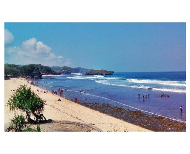
For instance, if a tsunami occurs, the community must know where they have to go. If you are on the beach and suddenly sense a big earthquake and see the seawater receding, you must immediately move away from the beach and go to a high place such as a hill or towering buildings.
“If you are more than 20 km far away from the coast, or in an area with the height of more than 30 m above sea level, there is no need to worry, the tsunami will not be possible to reach those areas,” she said.
Gayatri admits that research related to earthquake prediction has begun to be explained more seriously with various approaches, including seismicity analysis, interference with electromagnetic waves, the presence of Radon gas emission anomalies, and changes in groundwater levels.
Several researchers began to monitor various parameters in locations suspected of being tectonically active to determine the relationship between abnormal patterns and earthquake events. Several limitations in applying these methods include the sensor having to be close to the earthquake source and, most importantly, validating the data globally.
“Till this moment, research on earthquake prediction using these approaches has not yet produced predictions that consistently provide positive correlations. To be able to say that it is indicative, the results of monitoring must statistically reveal that there is a notable correlation between the incident and the oddity,” Gayatri said.
According to Gayatri, who also needs to know inactive subduction areas such as Sumatra and Java, earthquakes with small-medium magnitudes (<M4) occur almost every day. Suppose someone makes a very general prediction, for example, an earthquake with magnitude M4 will occur in the area along the Java-Sumatra subduction within a few days. People can’t say it was truly a prediction because it is always happening even without being predicted.
“Even so, we should keep proceeding with this study of earthquake predictions because if it is successful, it will provide human life with tremendous benefits,” she explained.
Regarding this disaster potential, the most important thing is how the government handles infrastructure preparation that supports the evacuation process, independent and coordinated evacuations, to anticipate an earthquake and tsunami. The government should plan and think about this from now on, for the long term, and sustainably, not only in response to the current issues.
Suppose there is excessive panic among people who live in areas hundreds of kilometers from the coast. In that case, said Gayatri, this shows the socialization process regarding the potential for disasters in Indonesian territory and how to respond to them has not been successful in its implementation. This kind of condition is absolutely homework among academics, the mass media, and the government to continue educating the public to be alert and not panic.
“It is necessary for the government to include material on disasters in the primary to the senior secondary education curriculum, compile disaster management protocols from the family to the community level, and support research related to disasters,” he said.
In her remarks, she said that the most important thing for the Indonesian is that they must understand that they live side by side with nature. Apart from the bad impact of disasters itself, Indonesia’s active tectonics also bring many benefits, including fertile land, beautiful scenery, and various natural resources.
“We are expected not to panic in facing potential disasters, identify the dangers in the environment, and learn how to save ourselves. Please follow the advice and directions from credible sources, do not forget to filter the news that either you heard or read, and don’t hesitate to ask those who are qualified in their fields if there is a problem so that you don’t get easily consumed up by disinformation issues,” he concluded.
Author: Agung Nugroho
Photo: infogunungkidul