


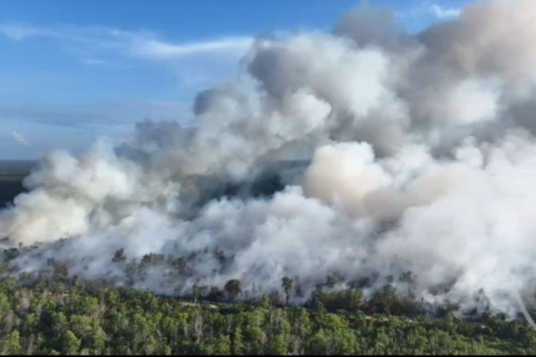
Forest and land fires continue to affect Sumatra and Kalimantan despite firefighting efforts at several locations. New fire hotspots emerged on other Indonesian islands, including in Merauke, Papua. Smoke continues to affect neighboring countries, Malaysia and Singapore, where haze has reduced air quality and left many residents suffering from acute respiratory infections (ARIs). Several schools in Malaysian states have also remained closed to in-person learning.
Fiqri Ardiansyah, a forest and land fire expert at UGM’s Faculty of Forestry (Forestry UGM), explained that one reason fires continue to occur in Indonesia is the prolonged El Niño period. Near-zero rainfall has further increased the vulnerability of fuel sources, including peatlands.
“Rainfall is indeed minimal, and this is no longer the beginning of the season. As the El Niño period progresses, rainfall approaches zero, making fuel sources such as peat more vulnerable,” he said in an interview on Wednesday (Oct. 14).
This vulnerability increases as the dry season progresses to insufficient water to maintain moisture in combustible materials. Nevertheless, drought alone does not directly cause fires. Forest and land fires still require an ignition source that interacts with fuel and oxygen.
“It is not the peat itself that causes fires. Fires occur through the interaction between an ecosystem and a heat source. Forest and land fires can occur in various ecosystem types, both peatland and non-peatland. The main difference lies in the characteristics and behavior of the fire once it starts,” he explained.
In non-peatland ecosystems, fires generally occur at the surface and can spread into the vegetation canopy. In peatlands, however, fires can burn both the surface and underground layers. This makes detection and suppression more complicated because smoldering sources are not always directly visible.
Peat fires can leave embers smoldering beneath the surface even after visible flames have been extinguished. If water is applied only to the upper layer, embers deeper underground may persist and trigger new hotspots.
The success of firefighting efforts depends on the fire’s depth and location. If water does not reach the burning peat layer, the fire may reignite or spread to surrounding areas.
“Signs of underground fires can actually be identified through drying vegetation, curled leaves, and the appearance of smoke even when no flames are visible,” he said. Fire suppression must therefore be accompanied by adequate assessment to ensure that the source of the embers has been fully extinguished.
In addition to peatlands’ characteristics, limited access to fire locations also challenges firefighting efforts. Some hotspots are in hard-to-reach areas, while water supplies, personnel, and firefighting equipment remain limited. Once a fire spreads over a larger area, extinguishing it requires more resources and time.
“In some areas, water sources are limited, so fires cannot be extinguished immediately. The fires also continue to spread, while personnel and firefighting facilities are limited in certain regions,” he explained.
To monitor forest and land fires, Indonesia already has several hotspot monitoring systems, including the Fire Information for Resource Management System (FIRMS), Sipongi, and information provided by the Meteorology, Climatology, and Geophysics Agency (BMKG). In his view, these technologies are already quite effective at detecting hotspots.
“Current hotspot detection capabilities are quite good. However, detection data must still be interpreted by taking the confidence level into account,” he said.
Fiqri also highlighted challenges in improving these technologies’ effectiveness.
“The next challenge is to improve the effectiveness of firefighting technologies and methods, particularly for fires burning beneath the peat surface. Several approaches have been developed, including injecting water into peat and using materials to cool or isolate the fire,” he said.
Nevertheless, firefighting strategies and the materials used still require further development to ensure that fires are completely extinguished at their source.
Fuel distribution, topography, and climate, including wind direction, also influence fire and smoke propagation. These factors determine how fires develop and where smoke travels, allowing the impacts to spread far beyond the original fire locations.
According to him, forest and land fire management cannot rely on rainfall alone as a solution.
“Prevention efforts must include raising public awareness about avoiding the use of fire for land management and preparation, particularly in areas vulnerable to fires during the dry season,” he said.
Meanwhile, tackling fires that have already started requires collaboration across agencies and priority areas based on risk levels. These should take into account ecological impacts, economic losses, and social consequences for communities living near affected areas.
“Efforts must involve not just one agency but multiple agencies. Responses can be directed toward priority areas that face particularly high risks,” he said.
Prevention and firefighting efforts must go hand in hand. Monitoring vulnerable areas, developing firefighting methods, and strengthening interagency coordination are essential to reducing the risks and impacts of forest and land fires, particularly when dry-season conditions increase the vulnerability of fuel sources to ignition.
Author: M. Aidil Syahputra
Editor: Gusti Grehenson
Post-editor: Jasmine Ferdian
Photo: Kompas.com