

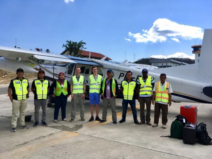
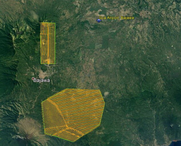


Researchers from Universitas Gadjah Mada and the University of Twente, Netherlands, conducted joint research to collect data on geothermal potential in Bajawa, Flores Island, East Nusa Tenggara. Using Light Detection and Ranging (LIDAR) to get aerial mapping and retrieve surface temperature, the survey receives full support from ASI Pudjiastuti Geosurvey. It will take place over the next two weeks, led by Dr. Agung Setianto, researcher in Department of Geological Engineering, Faculty of Engineering UGM.
Agung explained that his team used aerial data which combined high-precision LIDAR field data and surface temperature data. Then, the data will be processed to map surface expressions of geothermal potential underneath. “It will be Indonesia’s first data on Bajawa’s geothermal potential,” stated Agung in a release sent to journalists, Wednesday (9/19).
The collaboration with researchers from the University of Twente’s Faculty of Geo-Information Science and Earth Observation is a follow-up of the memorandum of understanding between the three parties held during the Indonesian International Geothermal Conference and Exhibition (IIGCE) in September 2018, Jakarta. According to Agung, the signing was witnessed by representatives of the Royal Netherlands Embassy and coordinators of the Indonesia-Netherlands Geothermal Capacity Development Program (GEOCAP).
Meanwhile, the survey was funded by PT APG and GEOCAP. The GEOCAP is an international collaboration between Indonesian and Dutch entities that aims to develop geothermal programs for education and training, research, and subsurface databases. “The program itself is funded by the Netherlands Ministry of Foreign Affairs,” he said.