

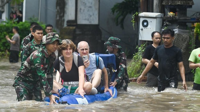
The flash floods that struck Bali and East Nusa Tenggara (NTT) in September 2025 have drawn serious attention. Despite occurring in the middle of the dry season, the floods were triggered by extreme rainfall exceeding 300 millimeters in a single day, according to the Meteorology, Climatology, and Geophysics Agency (BMKG). This phenomenon raises questions about the readiness of spatial planning, infrastructure, and communities in anticipating increasingly unpredictable extreme weather.
Professor of Environmental Geomorphology at the Faculty of Geography, Universitas GaSustainable Urban Planningdjah Mada (Geography UGM), Djati Mardiatno, explained that Indonesia is currently entering the transitional season between dry and rainy periods.
He noted that the floods in Bali and NTT were caused by a combination of extreme rainfall and reduced land cover.
“The reduction of forests converted into built-up areas has caused more rainwater to turn into surface runoff instead of seeping into the ground. This large volume of runoff is what can trigger flash floods,” he said on Wednesday, Sep. 17, 2025.
Professor Mardiatno stressed that the greatest challenge in addressing flash floods lies in the wide area affected and the number of vital urban facilities at risk.
Therefore, he emphasized the need for long-term solutions through spatial planning.
“We must expand green open spaces to allow rainwater to infiltrate into the soil, restrict the conversion of forested land, and ensure rivers are not clogged with waste so that drainage systems function optimally,” he added.
Similarly, Professor Bakti Setiawan, urban planning expert from the Faculty of Engineering (FT UGM), highlighted that floods are not only driven by natural factors but also by human activity.
“There are external factors such as climate change, but there are also internal factors, namely weak spatial planning and uncontrolled urban development. Thus, the main challenge is poor spatial and urban planning in anticipating disaster risks,” the expert said.
Professor Setiawan emphasized that future solutions must focus on spatial planning and controlling urban development based on disaster risk reduction.
He also underlined the importance of community resilience.
“Strengthening community resilience through the reinforcement of social capital, both structurally and culturally, is necessary to ensure that people are better prepared to face disasters,” he explained.
Both experts agreed that in responding to extreme weather, the roles of government, academics, and communities must align.
Local governments are expected to prepare contingency plans and enforce spatial regulations, while academics contribute through research, mapping, and community outreach.
On the other hand, communities are encouraged to enhance preparedness with simple actions such as constructing infiltration wells, creating biopores, maintaining green spaces, and refraining from littering rivers.
With controlled spatial planning, mitigation-based policies, and resilient communities, the risks of hydrometeorological disasters such as flash floods can be reduced.
Disasters, after all, are not solely natural occurrences but also reflect how humans manage their living spaces.
Author: Kezia Dwina Nathania
Editor: Gusti Grehenson
Post-editor: Lintang Andwyna
Photograph: Antara